- Introduction
- Open source geospatial software
- Propensity to Cycle Tool
- Live demo
- Bonus: research ideas
The Propensity to Cycle Tool: An on-line interactive web tool for transport planning
Robin Lovelace, University of Leeds. Slides: robinlovelace.net
19th Nov. 2015, UCL Geospatial Science Seminar Series
Presentation structure
Introduction
A little about me

Career progression
- Geography
- Bicycle mechanic
- Environmental science
- Some engineering!
- Energy studies
- Geography (with computers!)
- Transport studies
The wider context

I: Software
Transport planning tools: expensive…

And difficult..
Proprietary software cannot be:
- modified
- shared
- updated
And dangerous!

Source: Who will save us from transport models (Hollander 2015)
The solution
- Go Open Source!

Jobs
- The global transition away from fossil fuels is big business
- Many cities are scrambling to make their cities healthier and cleaner
- Check out some of the jobs that are available, decide which one YOU want
Good transport companies - ready for a transition away from fossil fuels:
Opportunities

New tools of the trade
- QGIS
- GRASS
- R
- Python
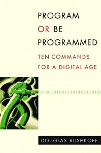
Program or be programmed
R's spatial ecosystem

http://www.maths.lancs.ac.uk/~rowlings/Teaching/UseR2012/introduction2Talk.html
QGIS

New software: aequilibrae

Why R?
See the free, open source, online tutorial github.com/robinlovelace/Creating-maps-in-R.

The packages used
Can be installed and loaded in 6 lines of code:
pkgs <- c("devtools", "shiny", "rgdal", "rgeos", "ggmap") # official packages install.packages(pkgs) library(devtools) # enables installation of leaflet gh_pkgs <- c("rstudio/leaflet", "robinlovelace/stplanr") install_github(gh_pkgs) # install packages on github lapply(c(pkgs, "leaflet", "stplanr"), library, character.only = T) # load all
RStudio
RStudio Desktop is highly recommended for Shiny development.

Shiny
shiny is a framework for creating online interactive data visualisation 'apps'.
- A framework for making R output interactive
- An 'app' development framework
- A (small) growing community of developers centred around RStudio
- A way to structure online tools: separation of GUI and server via
server.Randui.Rfiles.
Alternatives
- animate package
- Google Charts (googleVis::) and
- plotly
- D3
- Tableau
For maps
- Leaflet (supported by Shiny)
- Google Maps API
What's shiny good (and not so good) for?
Build's on R's existing strengths
- Data visualisation (ggplot2)
- Increasingline widely understood language for querying data
- Amazing range of add-on packages
Flexibility
Not so good for
- Scalability
- Database interaction
- Low-level control
What do shiny apps look like?
# type this to find out! runExample()

More examples
See geo8.webarch.net/robin/rentSplit/
GEOSTAT 2015 Visualisation Competition winner: geo8.webarch.net/robin/vizcomp/
Leaflet
An R interface to the Leaflet JavaScript library, compatible with Shiny.
cent <- geocode("Girona") leaflet() %>% addTiles() %>% addCircleMarkers(data = cent)
II: The propensity to cycle tool (PCT)
Policy context
- House of Commons Criticising the DfT for using closed models
- 'Impact' and 'engagement' increasingly important for research funding
- Complex data cannot be adequately summarised in a single static graphic
- Phase I: proof of concept (February - August 2015)
- Phase II: nationwide deployment (November 2015 - 2018)
Interactive online tools
- AURIN
- Leeds-Bradford cycle path interactive map
- DECC's 'Energy 2050' planning tool
- Walkability index site
- Interactive download of bicycle paths
Design criteria
- Interactive basemap
- Points, lines and polygons
- Cascading effects of different scenarios > - Tidy!

Early user testing

The underlying theory
- Check out our paper: http://arxiv.org/abs/1509.04425
Live demo!
See here: geo8.webarch.net/master

Zoom-dependent selection and freeze Scope

Model output tab I: Coventry

Model output tab II: Manchester

Planned feature: network tab
Estimating cycling rate allocated to the road network with https://t.co/DuzyCQCA50. Looks like streams + rivers! pic.twitter.com/geaV0mVKdG
— Robin Lovelace (@robinlovelace) August 17, 2015
Other planned features
Beta
- Network analysis (various options)
- Hilliness allocated to cycle network
Version 1 - nationwide (June 2016)
- HEAT outputs
- Incorporation of user feedback
- Travel to school layer (data pending)
Version 2 - nationwide (June 2017)
- Micro-level analysis
- Socio-demographic variables (new scenarios?)
Potential futures: e.g. community contributed
- Custom scenarios (e.g. 20% cycling by 2020 in Bristol)
- Custom scenarios (e.g. 10% cycling by 2020 in Manchester!)
- Scenarios estimating impacts from specific interventions
- International comparisons of propensity to cycle
- A global propensity to cycle map?
Fork my code!

- The work is open source so can used as a foundation for further work by others
- E.g. councils with the technical know-how
- E.g. cycle campaigner 'hackers'
- Check out the project's repository: github.com/npct/pct-shiny
Example: Trinity Way, Manchester

IV Live demo!
V Study ideas
1: identify what you're motivated by

How could transport infrastructure change if people worked from home?

How best to reallocate space away from cars?

How transport engineers can encourage car sharing?

Links and references
R vs QGIS for transport planning: http://robinlovelace.net/r/2015/04/20/r-vs-qgis-for-transport.html
Aequillibrea: transport planning toolbox - http://www.aequilibrae.com/
Lovelace, R., Goodman, A., Aldred, R., Berkoff, N., Abbas, A., & Woodcock, J. (2015). The Propensity to Cycle Tool: An open source online system for sustainable transport planning. arXiv preprint arXiv:1509.04425.
Use Google and your imagination
Code is good but start with a pen and paper!