Modelling multi-model traffic, casualties and risk
A data-driven approach to improve government guidance on critical safety issues for walking and cycling
June 27, 2026
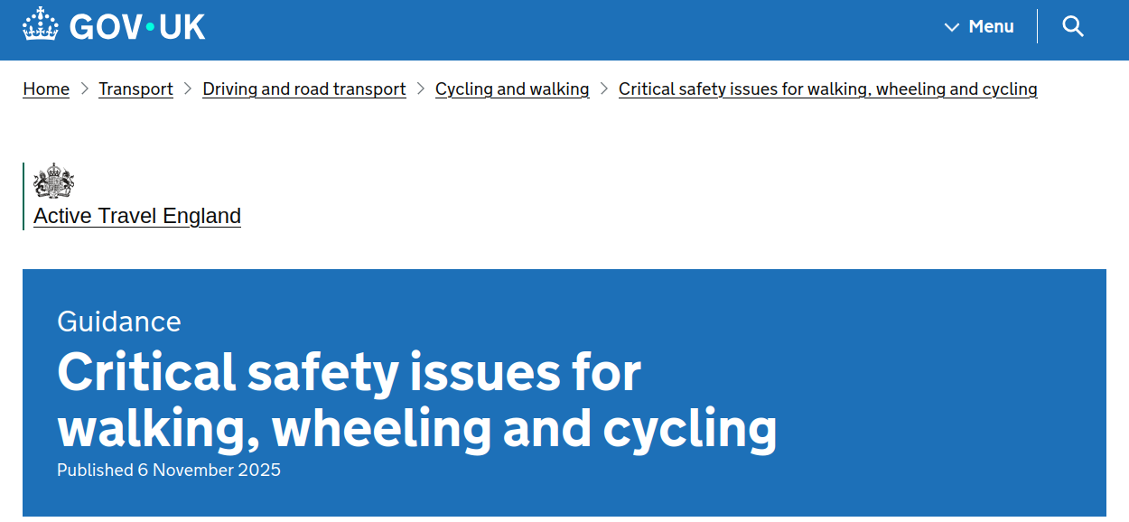
Context: Active Travel England guidance
- Project commissioned by ATE and delivered as a collaboration between Mott MacDonald and the University of Leeds
“A critical safety issue is defined as a street layout or condition that is associated with an increased risk of collisions for people walking, wheeling or cycling.”
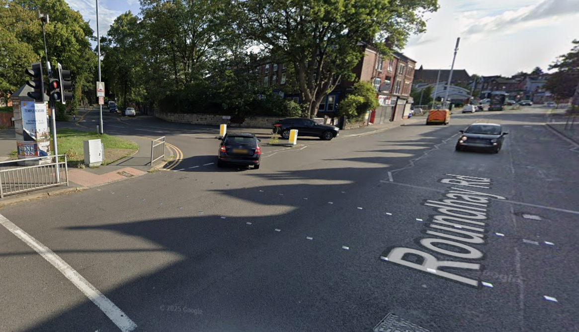
Spot the critical issues

Source: Robin Lovelace, action-based research
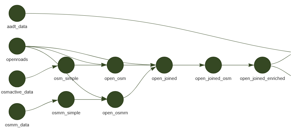
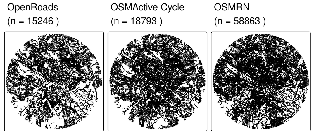
Input datasets
- OpenRoads, OSM, OSMRN — Best of all worlds network data
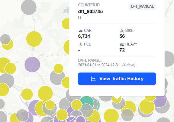
- STATS19 — Collision data
- Counters + model — AADT estimates
- OSM — Crossing type, footway width
- MMTopo — Pavement geometry
- Modelling framework: Bayesian regression (brms) \(Y \sim f(X)\) — will give confidence intervals in results
Variables and units of analysis
| Datasets | Variables | Critical issues |
|---|---|---|
| OpenRoads | Road name | All |
| OSMRN | Road width | SA03 |
| Motor traffic speed | SA08 | |
| Counters + model | AADT | SA01, SA02, SA09 |
| OSM | Crossing type | SA06, SA07 |
| MMTopo | Footway width | SA11 |
Source: RL (Excalidraw)
Assumptions and scope
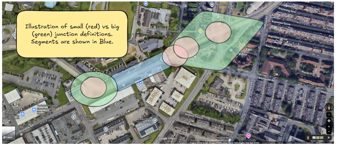
- Bigger (green) or smaller (red) representations of junction systems (big to start)? — We went green
- Should we calculate corner radii for junctions (not in first instance)? — Only if time allows
- How to handle refuge islands (ignore in first instance)?
- Do we include cycleway widths, surface, level of service (no)?
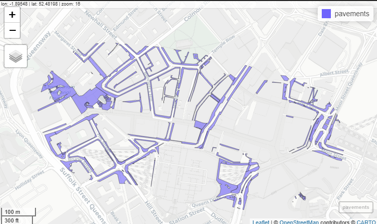
Sample of pavement geometry data
Source: Ordnance Survey. Action: obtain national pavement dataset.
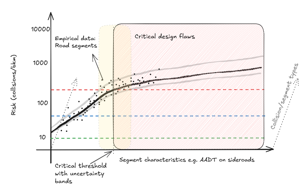
Proposed approach: statistical framework and envisaged outputs
- For each variable we will model impact on collisions/ksi
- What is acceptable risk?
- Thresholds for junctions vs segments?
- N. variables vs statistical power
- Result: unified framework for comparing multiple characteristics associated with Critical Issues and their interrelations
Source: University of Leeds
Approach: Modularity
Most research builds on more-or-less shaky foundations.
We’re aiming to build strong foundations.
That means publishing data outputs and open tools (R/Python packages) where possible (Lovelace 2021).
Example: github.com/itsleeds/vivacitypy

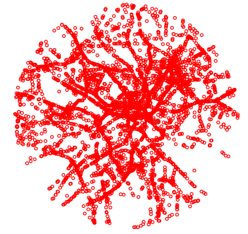
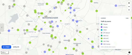
Counter locations
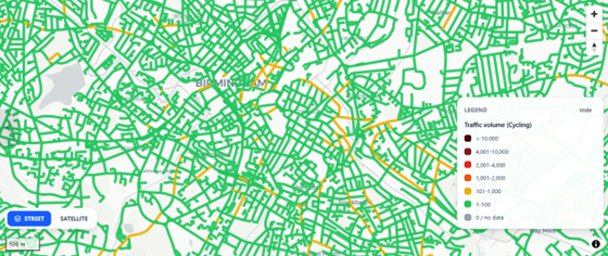
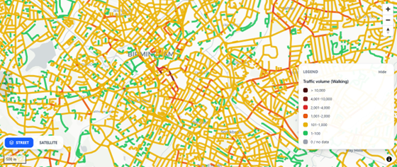
Cycling estimates
Walking estimates
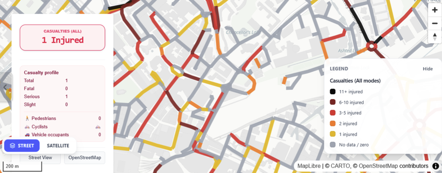
Modelling collisions at the junction level

Modelling collisions at the segment level
Modelling pedestrians at the crossing and sidewalk level
Detailed modelling of pedestrian crossings and sidewalk geometry is necessary for proper active travel analysis but is outside the scope of the current project.
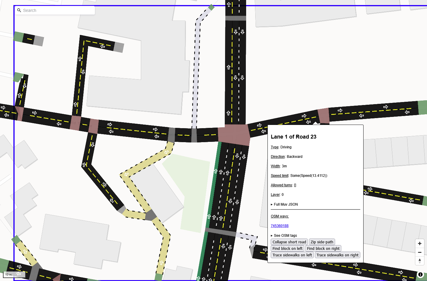
osm2streets: tool for generating detailed street cross-sections from OSM data.